For decades, species watchlists have helped quantify the plants and animals most at risk of extinction and inform conservation actions. The WatchList of Terrestrial and Freshwater Bird Habitats of the U.S. and Canada — the Habitats WatchList — developed by American Bird Conservancy in partnership with NatureServe and Habitats of the World authors Iain Campbell and Philip Chaon, offers a new look at habitats: through birds. By knowing the habitats birds depend on, we can then measure the threats to those habitats, and target conservation to protect and improve them. We can't conserve birds without considering habitat — the two are intimately linked.
The habitats in the WatchList are identified based on their bird communities, the Indicator Species. The habitats used by these species may not map neatly onto existing habitat maps based on vegetation and other abiotic factors. Once the habitats are identified, we can measure their level of threat from such factors as development and climate change, yielding insight into some of the most unique and endangered places in the United States and Canada.
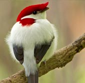
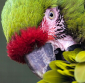
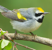
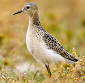
Many bird species are generalists; they're highly mobile and less sensitive to environmental change than plants might be. But birds that are specialists — like the Kirtland's Warbler, which relies on jack pines within specific age and height ranges for breeding — are characteristic of the habitats they use. Their relationship to habitat is so strong that they may be found only in that habitat or a few very similar habitats. We call these birds Obligate Indicator Species. Other birds that may be found only in a few habitats are Strong Indicator species.
The Habitats WatchList pairs bird communities with vegetation-based habitat maps to identify terrestrial, freshwater, and coastal habitats across the U.S. (including Hawaiʻi and Alaska) and Canada. Each habitat is scored based on seven criteria such as the threatened status of the Indicator Species found there and the likelihood of future conversion or climate change impacts (see additional scoring criteria below). The most threatened habitats are added to Red and Yellow WatchLists, below, indicating their significance to birds and the need to prioritize conservation actions in these places.
Using the Explore App: Zoom in or out (scroll with your mouse or use the + and – buttons at the bottom of the map), or pan (click and drag). The list of habitats will appear in the Habitat List (left). Find a specific habitat using the search bar (magnifying glass icon).
Selecting a habitat from the Habitats List will show a range highlighted in gray on the map. Similar to a bird species' range map, the selected habitat occurs within the highlighted area, but not necessarily at every point.
Click on a habitat from the Habitat List or the map to access information in the right-hand panel. Use the arrows or tabs at the bottom of this panel to see a Habitat Description, Indicator Species present in the habitat, the habitat's overall weighted threat score, and the seven measures that make up that score.
Scoring Habitats
The Habitats WatchList uses seven criteria to evaluate the threat level a habitat is currently experiencing:
A weighted sum of the scores on these seven factors can range from 10 to 100, with higher values indicating a greater level of threat to a given habitat. The highest-scoring habitats are added to the Red WatchList or Yellow WatchList, representing the habitats most at risk and requiring conservation action.
Technical Details
Definitions
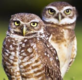
Indicator Species: Bird species that are characteristic of a particular habitat and which only occur in that habitat or in a few similar habitats. Indicator Species tend to be specialists on one or a few aspects of a habitat.
Threatened Birds: Indicator Species that appear as Endangered or Threatened under the U.S. Endangered Species Act, as Endangered or Threatened under the Canadian Species at Risk Act, or in the U.S. Fish and Wildlife Service Birds of Conservation Concern 2021 list.
Details on Scoring System
Bird Conservation Concern: Obligate and Strong Indicator Species are scored based on whether they appear on one or more of these four lists of threatened species. The score is further weighted by the level of threat (whether the species is listed as Endangered or Threatened).
If an Obligate or Strong Indicator Species did not appear on any of these lists, it received no points. If a species appears on more than one of the lists, it receives the total for the score on each list. Therefore, species such as Whooping Crane, which appears as Endangered on both the ESA and SARA, Endangered on the IUCN Red List, and on the USFWS Bird Species of Conservation Concern list, receives 15 points for those habitats in which it is an Indicator Species.
Indicator Species that appear on one of these lists for only part of their range are scored only for those habitats where they are Indicator Species and also listed as some level of conservation concern.
Indicator Bird Species Score: For each habitat, each Obligate species is scored 6 points and Strong Indicator Bird species are scored 3 points. Therefore, a habitat with one Obligate and three Strong Indicator Species is given a score of 12 points.
Extent Score: The area of each habitat in square kilometers.
Protection Score: The proportion of each habitat that is in GAP Status Code 1 and 2 protected areas (USGS Gap Analysis Project) and IUCN Protected Area Management Category I-VII (Canadian Protected and Conserved Areas Database).
Likelihood of Conversion Score: This score is calculated from the Land Cover Vulnerability Change (LCVC) dataset and indicates the chance that a habitat will be converted to another habitat type, potentially through development or agriculture.
Landscape Condition Score: Based on NatureServe's Landscape Condition Model, this score assesses the physical condition of landscapes; habitats with landscapes in poorer condition are more threatened and thus are scored higher.
Climate Score: A metric developed by NatureServe that measures a habitat's vulnerability to climate change impacts; habitats more threatened by climate change are scored higher. This score is based on average climate velocity (i.e., rate of adaptation needed for species to remain in suitable climate envelopes), as calculated by AdaptWest (North America) and Chelsa Climate (Hawaii).
Calculation of Scores from Decile Codes
Each of the seven measures produces a raw value. These values are sorted and converted to deciles coded from 1-10, with higher values indicating greater importance of the habitat. Higher values for most of the measures (four measures) are given higher scores. For three measures, however, this is reversed: lower values receive higher scores. These are:
Decile values for four of the measures were further weighted:
The remaining three measures (Indicator Bird Species, Landscape Condition, and Climate) were not weighted; only their decile rank is used.
The sum of the scores of the seven measures, therefore, can range from 10 to 100, with higher values indicating higher threat to the habitat. This value is the Overall Threat Score.
Overall Threat Scores 68 or higher are listed as Red Habitats WatchList. Overall Threat Scores higher than 62 but less than 68 are listed as Yellow Habitats WatchList.
Eleven habitats are mapped but not scored. These are strictly marine habitats and human-made habitats.
Creating the Habitats WatchList
The concept and the identification of habitats used in the Habitats WatchList is similar to the system developed independently by Iain Campbell and coauthors in Habitats of the World and its follow-up, Habitats of North America by Iain Campbell and Philip Chaon. Although we collaborated with Iain Campbell to harmonize our habitat systems, they are not identical.
The habitats in the WatchList were determined by identifying unique bird communities composed of Indicator Species (specialists found only in one habitat, or in a few very similar habitats), joined with the vegetation categories found where these birds occur. NatureServe's vegetation classification is the basis of the Habitats WatchList map.
Our scoring system was developed to quantify the value of a habitat to birds, and the threat level that habitat is experiencing. Some of the seven criteria outlined above used in our scoring system are based on birds, while others are based on threats to the habitat itself. Note that strictly marine habitats are not scored, and most human-made habitats (urban, suburban, tree plantations, etc.) are mapped but not scored.
ABC thanks Iain Campbell, Princeton University Press, Philip Chaon, NatureServe, Regan Smyth, Christopher Tracey, Sara DeCaro, Hannah Ceasar, Jordana Anderson, and the Sustainable Forestry Initiative.