


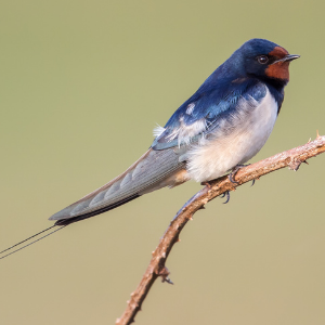


When Will Migratory Birds Arrive? Find Out Using These Bird Migration Maps
Not so long ago, knowing when and where to find migratory birds was something of an art. Weather conditions, resource availability, and other factors meant that best guesses as to when birds would arrive were often imprecise. Many birders relied on sage advice from more experienced observers, dial-in hotlines for reports of rare birds, word of mouth, and luck in their pursuit of migratory birds.
Then came the Internet. In a few short years, science (mostly) replaced luck, as birders learned to harness the power of data-driven online migration tracking tools. We can now anticipate migration in ways that would have been unimaginable to previous generations. It's possible to track the movements of individual species, predict when massive numbers of birds will be on the wing, and get updates about observations in your area with no (or minimal) lag time.
There is no shortage of options when it comes to migration maps. Most use distinct data sources and can serve different purposes, depending upon the user's needs and interests. To help you decide which sources are right for you, we've listed some popular migration mapping tools below. This list isn't comprehensive — and we're not endorsing specific sites — but it's a good place to get started.
Birding has been radically changed by our ability to better understand migration, but so has conservation. These tools help us explore the wonder of birds while also providing invaluable data to inform conservation decisions and make birds' journeys safer.
We now know more about the mounting threats birds face — from habitat loss and pesticides to free-roaming cats and window collisions — and how to combat them. American Bird Conservancy (ABC) works with partners across the Americas, taking bold action to protect migration from breeding territories to nonbreeding grounds and everywhere in between. You can support this work and take action at home as you prepare for the flurry of migration activity ahead.
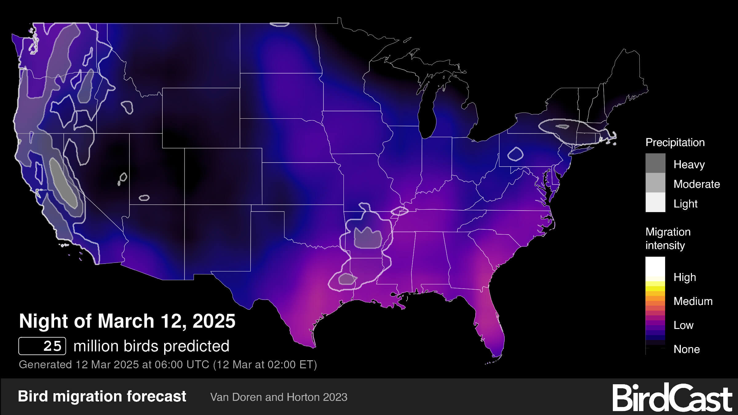
BirdCast
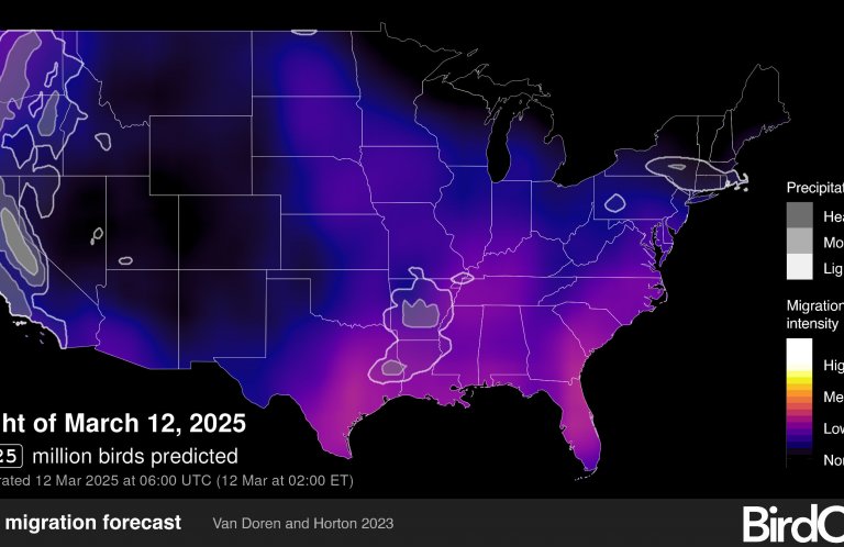
BirdCast offers a forecast service unlike anything else available. Using weather forecasts, radar data, and computer modeling, BirdCast predicts where migration is most likely to occur in the coming days. The site, created by scientists at the Cornell Lab of Ornithology, also provides real-time migration maps, indicating where migrants can currently be found and the direction they're headed. BirdCast provides counts of the number of birds flying through your state or county the previous night, as well as estimates of peak migration traffic, flight direction and speed, and expected species on the move.
When it comes to providing an accurate overall picture of migration, BirdCast has few competitors. But if you're looking for information on a specific species, such as the Baltimore Oriole or Rufous Hummingbird, check out the migration maps below.
eBird
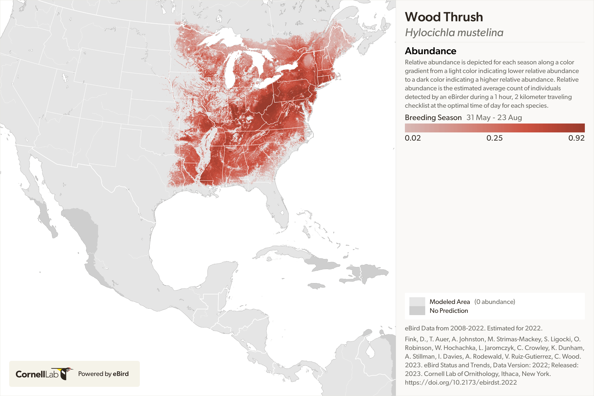
eBird is among the world's largest biodiversity-related science projects, an unparalleled resource with hundreds of thousands of users across the globe. Birders submit more than 100 million bird sightings annually, which eBird uses to spectacular effect. When it comes to spring migration, there are several ways to find detailed information about the arrival times of specific species. You can visit the species' profile page, enter your location, and check the weekly bar chart to see when observations begin. Alternatively, you can enter your region (eBird works at state and county levels in the U.S.) to find a list of recently reported birds. Or, you could explore “Species Maps” and zoom in on your location, where older reports will be marked in blue and recent in red. eBird's free mobile app makes it easy to find good birding locations (“hotspots”) near you.
If you're interested in learning where and when specific species migrate throughout the year, eBird offers high-res animated migration maps that combine observational data with NASA satellite imagery to provide a week-by-week overview of migration. eBird regularly releases new tools to visualize and explore trends in bird abundance, ranges, and more.
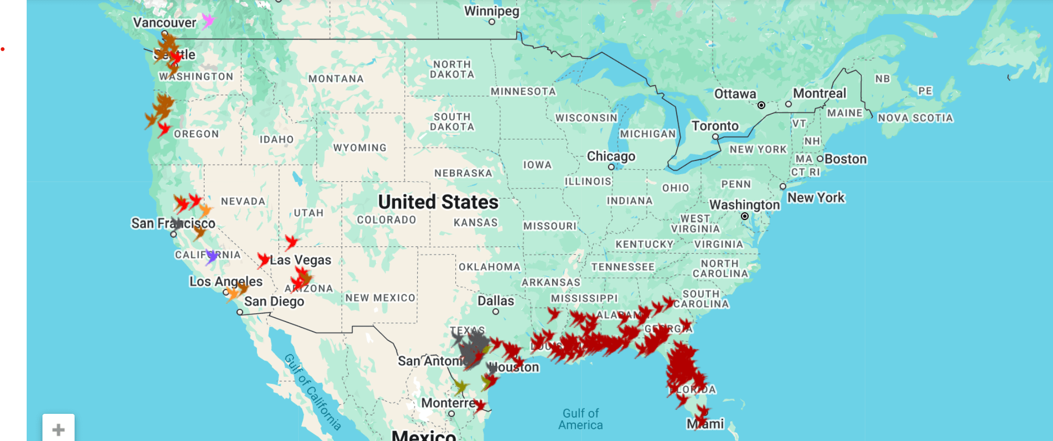
Hummingbird Central
Wondering when to put out your hummingbird feeder? Hummingbird Central provides an interactive map of first-observation reports from community contributors throughout the country. If you're curious about the movements of specific species, you're in luck: Hummingbird Central tracks 12 North American species by means of variously colored pins on their collaboratively produced maps. You can also contribute your own observations as species reach your area.
Journey North
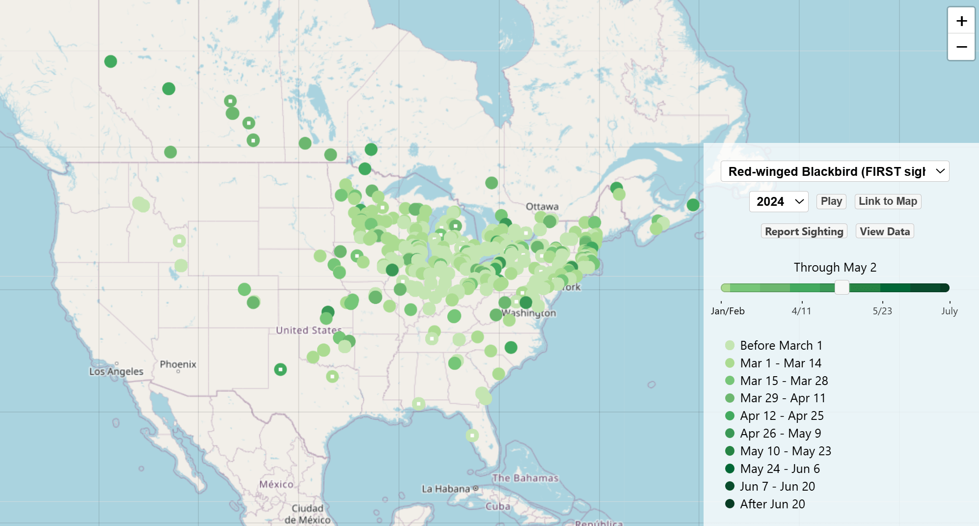
Journey North doesn't offer the massive data set that eBird and other sites do, but it does have a few unique migration maps. First-observation maps are available for orioles (Baltimore and Bullock's), American Robins, Red-winged Blackbirds, and hummingbirds (Rufous and Ruby-throated), among other species. And for those interested in tracking spring's wider progression, first-observation maps are available for Monarch butterflies, leaf-out, ice thaws, tulip blooms, and more. Like Hummingbird Central, Journey North welcomes reports of first observations of any of their tracked species or signs of season change, so you can contribute to this growing resource, too.