How Do Scientists Track Migrating Birds? A Look at Tracking Tech

ABC and partners are using GPS tags to track Swallow-tailed Kites along their incredible migration journeys to and from South America. Photo by David Spates, Google Earth image by ARCI

If you're interested in bird migration, you're probably familiar with the idea of scientists tracking birds' movements across the globe using tiny backpack-like devices. Knowing the routes individual birds take can be crucial for identifying the stopover sites and wintering grounds that declining bird populations rely on and, hopefully, taking action to protect them.

But these bird backpacks aren't all the same — there are many different kinds of tracking devices, each relying on different technology and coming with its own set of strengths and weaknesses. In celebration of spring migration, here is a summary of the various gizmos that ornithologists use to follow birds' inspiring journeys.

Radio Telemetry

American Kestrel wearing a Motus transmitter. The bird in this photo is being held by a trained professional with proper permits. Photo courtesy of MN Department of Natural Resources- Nongame Wildlife Program

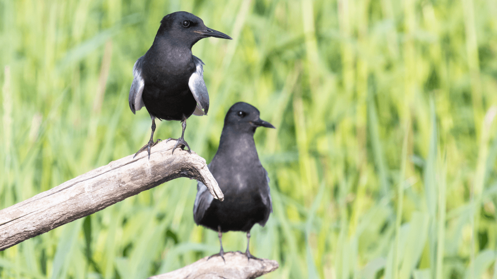
The earliest means of tracking the movements of animals in real time was radio telemetry (“telemetry” just means transmitting data collected at one location to another location). The invention of the transistor in the 1940s led to radios that were smaller and more reliable than ever before, making them suitable for new uses, including monitoring the movements of wild animals. Early experiments included surgically implanting radio transmitters in woodchucks, but by the 1960s, scientists were building transmitters small enough to be carried on the backs of large songbirds.

Of course, these radio transmitters only had a range of a few miles, so to track a migrating bird, a researcher needed to follow it cross-country. In May 1965, scientists in Illinois placed a transmitter on a Gray-cheeked Thrush captured in Illinois and followed it in a small plane when it took off at dusk for its nocturnal migratory flight, tracking it for 400 miles before turning back. 

The following decade, in 1973, one of the same researchers tagged another thrush in Illinois and was able to follow it for an entire week in a modified station wagon with a hole cut in the roof for a large radio receiver. He trailed it for more than 900 miles before losing the signal in Manitoba, Canada, during which time he gathered data on its airspeed, groundspeed, and heading each night.

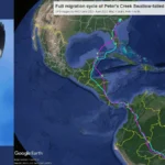
Today, a wildlife tracking system called Motus has eliminated the need for researchers to physically follow individual animals across the landscape. A network of more 1,500 Motus receiver stations around the world, the greatest concentration of which are in North America, “listen” for the signals of passing animals and record detections of any that come within range. Each individual animal being tracked by the Motus network has a transmitter that sends out a unique sequence of beeps, allowing its wearer to be identified. To date, almost 38,000 animals representing 317 species, mostly birds, have been tracked using Motus. American Bird Conservancy (ABC) is actively involved in expanding the Motus network in the Americas, helping to coordinate efforts across different regions and national borders.

Satellites

The solar-powered satellite tag on this Long-billed Curlew is capable of providing years' worth of data. The bird in this photo is being held by a trained professional with proper permits. Photo by Jessica Howell

If you want to be able to track birds over long distances without relying on a network of ground-based receivers, the best way to do it is from space.

The first satellite tracking devices for birds, built in the 1980s, relied on a satellite system called Argos. Launched in 1978 as a collaboration between NASA, the U.S. National Oceanic and Atmospheric Administration (NOAA), and France's National Center for Space Studies (CNES), Argos satellites determine the location of transmitters on the Earth's surface by analyzing how the transmissions are altered by the Doppler effect as a satellite approaches, passes over, and moves away from a transmitter. Originally intended for tracking ocean buoys, the system was quickly co-opted by wildlife biologists, and early satellite transmitters for birds were tested on species including the Bald Eagle and Trumpeter Swan.

Argos transmitters are still used for bird research, but GPS satellites, originally launched in the 1970s by the U.S. military, offer another option. This system became fully available for civilian use in 2020. Each of the 31 satellites in the system transmits the current time with extreme accuracy, and a GPS device on the ground receiving this information from four different satellites simultaneously can use it to calculate its own latitude, longitude, and altitude. ABC is currently using satellite tagging to track Long-billed Curlews on their migration journeys to inform habitat conservation efforts for the species. 

GPS devices worn by birds can then transmit this location data to scientists via another satellite system such as Argos, log it in their own memory banks to be retrieved when the bird is recaptured, or even send it out via the cell phone network. (This can lead to some unexpected results: In 2019, a group of Russian ornithologists tracking eagles racked up huge roaming charges when their birds unexpectedly wandered into Iran.) 

Light-Level Geolocators

The tiny geolocator on this Black Tern is attached to its left ankle. The bird in this photo is being held by a trained professional with proper permits. Photo by Lindsay Adrean

Satellite trackers are relatively heavy (although they're getting lighter all the time), and Motus transmitters only work if a bird happens to fly within range of a Motus receiver. But there's a third category of tracking device that's extremely small and lightweight and relies on navigation principles that date all the way back to the sixteenth century.

In the 1980s, a British penguin biologist was looking for a new way to track penguins' movements at sea when he came up with the idea to try using light sensors. The devices he invented, now known as light-level geolocators, consist only of a light sensor, a clock, a memory chip, and a battery. Because the length of a day varies with latitude, and the time of the day when the sun is highest varies with longitude, it's possible to estimate one's location using only light measurements and time.

Like some GPS devices, light-level geolocators record location data but don't transmit it, so birds wearing geolocators must be recaptured so that researchers can download the data. The location data they provide is also less accurate than data from other types of tracking devices. But their small size means they can be used on even very small songbirds such as warblers, and they've helped uncover critical details about these species' migratory patterns. ABC is hoping to use geolocators to shed light on why Black Tern populations are declining in the western United States. 

Interested in learning more about how scientists study migration? Check out Rebecca's new book, Flight Paths: How a Passionate and Quirky Group of Pioneering Scientists Solved the Mystery of Bird Migration, available from HarperCollins.

How You Can Help Migrating Birds

Migration season can be a particularly fraught and taxing time for migratory species, but there are ways that you can help ease their journey. 

Hundreds of millions of birds die from hitting glass every year, and almost half of those collisions are on home windows. Luckily, there are many ways to make your windows safe for birds. From tape to screens and films, effective, easy-to-install, and inexpensive home solutions are available to help reduce bird–window collisions and are available to peruse on ABC's website.

Free-roaming cats are natural predators whose presence alone can cause birds stress. If you have a cat, practice and advocate for treating cats like dogs — that is, providing safe and enriching places for pet felines to live indoors full time, or supervised and contained outdoors using a harness, backpack, or “catio.” Cat owners can also pledge to keep pets responsibly contained.

Pesticides can have both immediate and long-term negative impacts on birds visiting or breeding in your garden. Neonicotinoids (or neonics) — the most widely used insecticides globally — are used as seed coatings and found in products like insect sprays. One seed coated with neonics is enough to kill a songbird, and even less can harm a bird's reproduction. To weed your garden, use your own elbow grease or natural alternatives to chemical-based options.